Welcome to A People's Atlas of Nuclear Colorado
To experience the full richness of the Atlas, please view on desktop.
Navigating the Atlas
You may browse the Atlas by following the curated "paths" of information and interpretation provided by the editors. These paths roughly track the movement of radioactive materials from the earth, into weapons or energy sources, and then into unmanageable waste—along with the environmental, social, technical, and ethical ramifications of these processes. In addition to the stages of the production process, you may view in sequence the positivist, technocratic version of this story, or the often hidden or repressed shadow side to the industrial processing of nuclear materials.
Using the buttons on the left, you may also browse the Atlas's artworks and scholarly essays, access geolocated material on a map, and learn more about contributors to the project.
If you would like to contribute materials to the Atlas, please reach out to the editors: Sarah Kanouse (s.kanouse at northeastern.edu) and Shiloh Krupar (srk34 at georgetown.edu).
Cover Image by Shanna Merola, "An Invisible Yet Highly Energetic Form of Light," from Nuclear Winter.
Atlas design by Byse.
Funded by grants from Georgetown University and Northeastern University. Initial release September 2021.
Abbey Hepner, Uravan: Plant A, 2020, courtesy the artist
Artwork
Uravan
In western Montrose county, the town of Uravan, Colorado, can still be located on a map. However it isn’t easy to find because it is buried under layers of clay, soil, and rock. Standard Chemical Company established the town of approximately 1,000 residents in 1912, naming it after uranium and vanadium, two minerals mined in the area. Activities at the local processing mill contaminated the soil and groundwater with radioactive chemicals so much so that by 1986 the Environmental Protection Agency (EPA) closed the town and relocated residents. Uravan was shredded, burned, and buried by the EPA, creating a 680-acre Superfund site.
For Uravan, I created three-dimensional, laser-engraved pigment prints by photographing the exact locations as those in historical images of buildings that existed before the town was destroyed. Formed by the laser burning into layers of paper at various depths, the historic structures appear against bleak and empty contemporary landscapes.
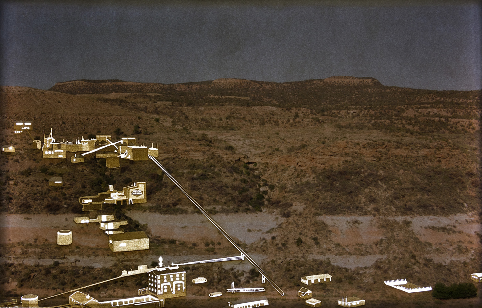
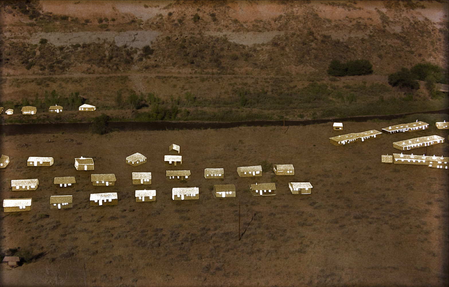
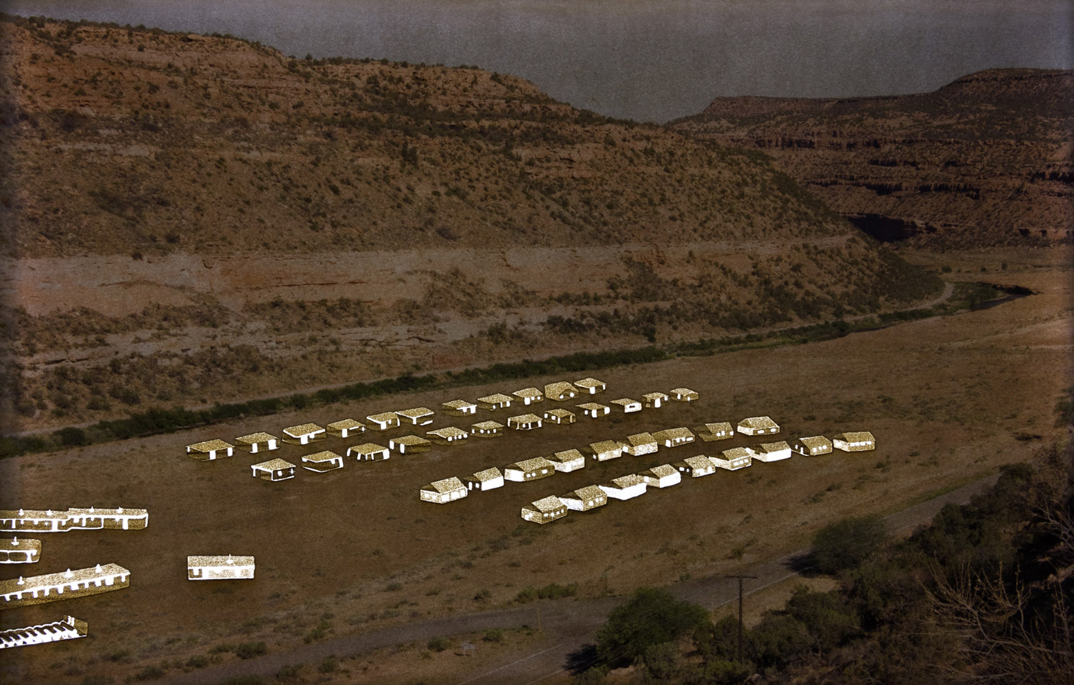
For Uravan, I created three-dimensional, laser-engraved pigment prints by photographing the exact locations as those in historical images of buildings that existed before the town was destroyed. Formed by the laser burning into layers of paper at various depths, the historic structures appear against bleak and empty contemporary landscapes.
Abbey Hepner, Uravan: Plant B, 2020, courtesy the artist
Abbey Hepner, Uravan: Block G, 2020, courtesy the artist
Abbey Hepner, Uravan: Block H, 2020, courtesy the artist
Citation
Abbey Hepner, Uravan, laser-engraved archival pigment prints over clear acrylic (backlit), 7.5 x 12 inches, ed. 5, 2020.Continue on "Artwork"